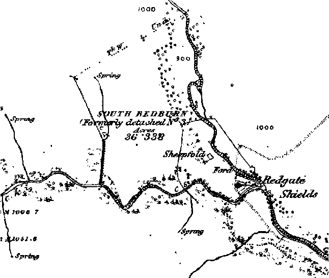
Redgate Shield
OS map reference NZ 0298 2965 at the head of the Euden Beck.
| On the 1753 Inclosure Map Redgate Shield is shown as belonging to Sir John Eden. An enclosure named St [sic] John's enclosure is shown on the west side of the Euden Beck, just down stream of the confluence of the streams; a house is shown inside the enclosure and named Redgate Shield. This house is not shown on the 1860s map (below). |
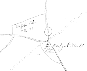 Tracing from Inclosure Plan |
The 1841 census lists John Burton, a 60 year old shepherd, and John Marquess, a 35 year old farmer living at Redgate Shield, but it is not listed in the 1851 census.
Keys to the Past
D3271
This is probably the date of a 15th century iron ore processing
site. The site consists of earthworks covered with grass and
trees, A dam and a channel upstream can also be seen. (The
Keys to the Past map shows the site on the east bank of
the Sharnberry Beck, just above the confluence) This
site may be partly confused with another nearby site.
D1753:-
A report written around 1440 by the Bishop of Durham's Chief
Forester suggests that an old iron forge stood at Redgate in
Hamsterley. Large amounts of slag and system of dams and
channels have been found in this area. The site may be partly
confused with a 15th century Iron ore processing site also known
from this area.
The account of the bishop's chief forester about 1440:-
"Concerning the farm of the iron-forge (forgei ferri)
of Redgate in Hamsterleward which was wont to return £6 13 4d
nothing here because no forge exists there. Nor concerning the
farm of the iron mine of Weardale which was wont to return 26s
8d annually, because Lord Latymer ought to make return in
respect thereof on account of a certain agreement as to it made
between him and the lord (bishop). Nor of the forge within the
the park of Bedburn because it is worked by (occupatur)
William Blirthorn on a lease from the seneschal. Therefore the
seneschal should make return in respect thereto."
Eccl. Com. Mins. Acts 190030 for the first and second years of
Bishop Neville
(Victoria County History: County Durham, Volume 2 (London
1907), 354)
(The location on the associated map - NZ 120 300 -is on the
Linburn Beck adjacent to Beckside Farm, south of Hamsterley.
This is almost certainly an error ).