The Old Road through Redford -
(from Barnard Castle to Hexham)
(This page at present is just a home for rough notes which I hope to pull together at a later date).
Nowadays a line of minor roads, 'green lanes' and footpaths between Barnard Castle and Hexham, this was for centuries a main route north - as shown by the following itineraries as late as 1811. It was definitely not suitable for wheeled traffic and the majority of travellers were probably making local journeys - for example there was almost certainly a trade in coal from West Pitts to Wolsingham and from there up Weardale. It could also well have been a drove road south skirting to the east of the highest ground of the Pennines.
A General Itinerary of England and Wales, with part of Scotland : Containing All the Direct and Principal Cross Roads .... by Davidy Ogilvy. Published by Robinson 1804
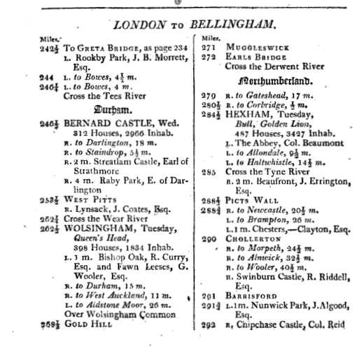
A new and accurate description of all the direct and principal cross roads in Great Britain ..... by Daniel Paterson. Published by Longman 1811
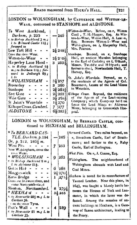
The route to the north of Wolsingham ran to the east of the Waskerley Beck up Baal Hill and across the moor to Salters Gate (see 1st Edition OS); from there along Saltersgate Lane to Waskerley and then keeping to the high ground to the west of Horsleyhope Burn it passed through Gold Hill before descending to Muggleswick to cross the Derwent at 'Earl's Bridge' (Eddy's Bridge?). (Not the Earl's Bridge at Dilston)